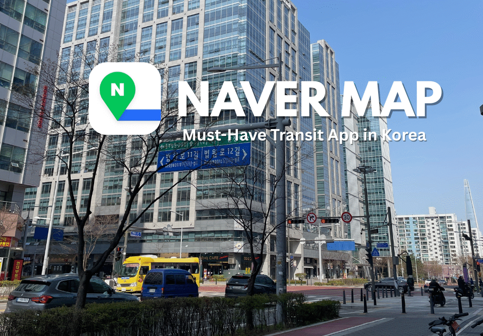
Understanding the local social culture is a must when traveling overseas. Like Google Maps in many countries, South Korea has its go-to navigation app: Naver Map. Trust me—if you’re planning a trip to Korea, this app will be a lifesaver. It’s designed for local use and works far better than Google Maps in many situations. So, what’s the difference between Google Maps and Naver Maps?
Better Time and Cost Planning for Transportation
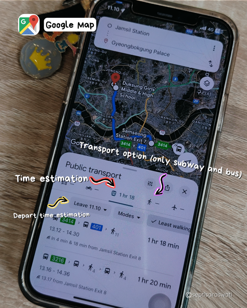
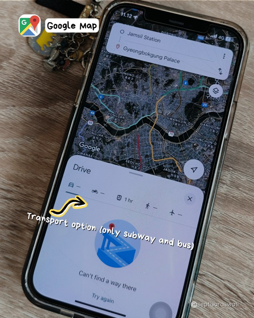
Google Maps is generally helpful for finding routes and estimated travel times, but not so much in South Korea. While it’s still somewhat reliable when traveling by public transportations like subway and bus, it’s a different story if you’re using private transportation (car, taxi, bicycle, motorcycle)—it becomes almost useless. Google Maps just show only general suggestions and rough time estimates for the subway, but the information is often inaccurate and lacks detail.
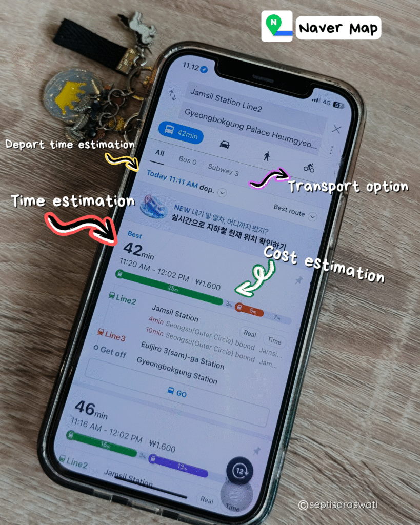
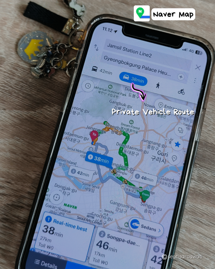
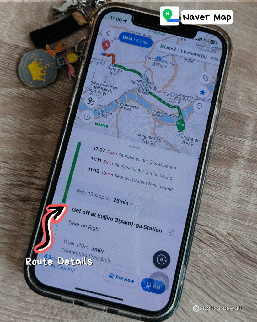
In contrast, Naver Maps is far more effective. It offers real-time information including travel time, fare costs, and the best routes based on your preferences. For example, if you’re traveling from Jamsil to Gyeongbokgung Palace, Naver Maps will show you multiple options: the fastest route, the most affordable one, or a route with the least walking and transfers (using a mix of bus and subway). It also provides detailed schedules for subway and bus arrivals and departures.
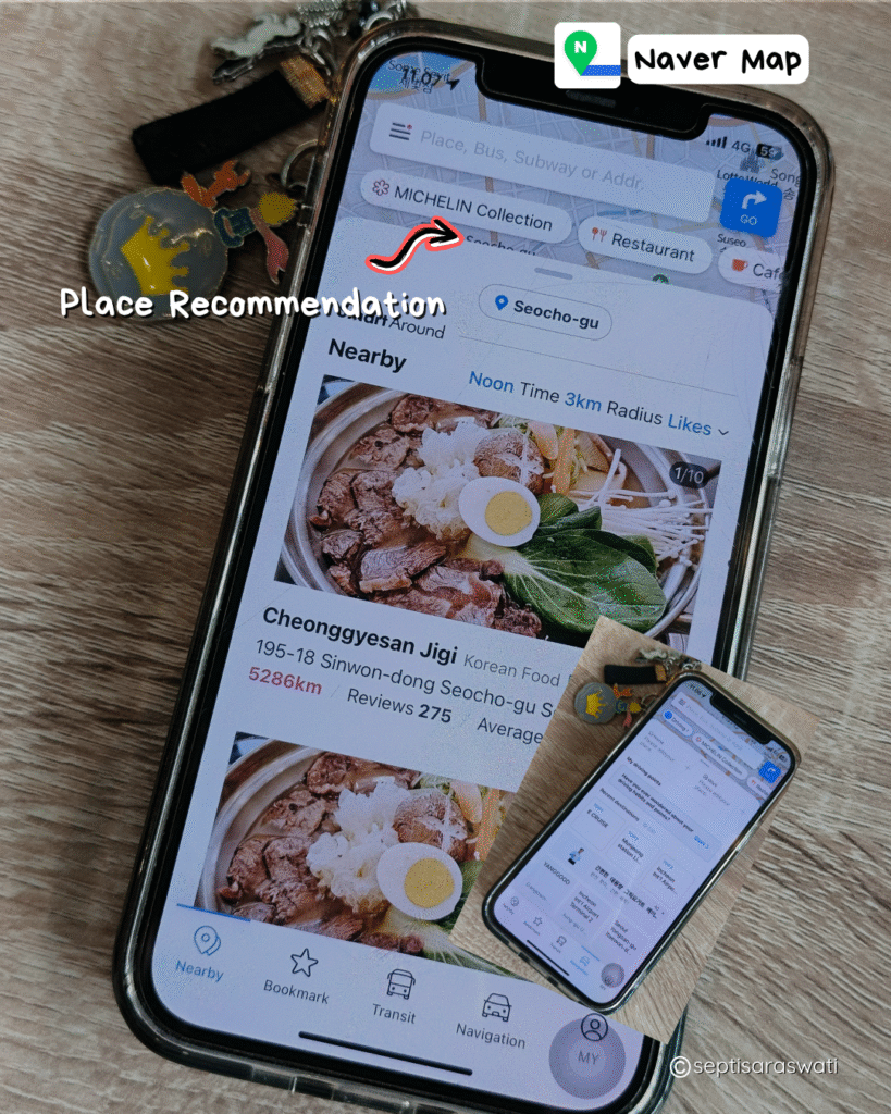
If you’re considering a taxi or driving a private car, Naver Maps includes estimated travel times and costs for those options as well. Additionally, it highlights nearby attractions and points of interest around your destination—perfect if you’re unsure of what to do once you arrive.
Bonus Tip:
I made a 15-day itinerary for my trip to Korea a month before arriving, and Naver Maps was incredibly helpful. It allowed me to plan transportation, time, and budget in advance. You can select the exact day and time you plan to travel between destinations, making your schedule more efficient and stress-free.
Naver Map can be used anywhere in South Korea
Not only in Seoul, Naver Map works great in other cities as well. I used it during my trips to Suwon and Busan, and it was incredibly helpful. I took a one-day trip from Seoul to Suwon because I had to adjust my itinerary due to a political demonstration in central Seoul. Fortunately, Naver Maps made it easy to create a new, impromptu plan without any stress.
While in Suwon, I used the app to find restaurants, cafes, and even K-drama filming locations—just by searching on the map. In Busan, I also made some spontaneous travel decisions, like visiting Oryukdo, and Naver Maps helped me get there smoothly. It truly made my journey more convenient and flexible.
More Travel Tools at Your Fingertips – All in English
Even though Hangul is everywhere in South Korea, Naver Map makes things easy by offering an English option. Plus, it’s more than just a map—you can book trains and cars, find parking spots, gas stations, attractions, and cafes, all with reviews to help you choose the best spots.
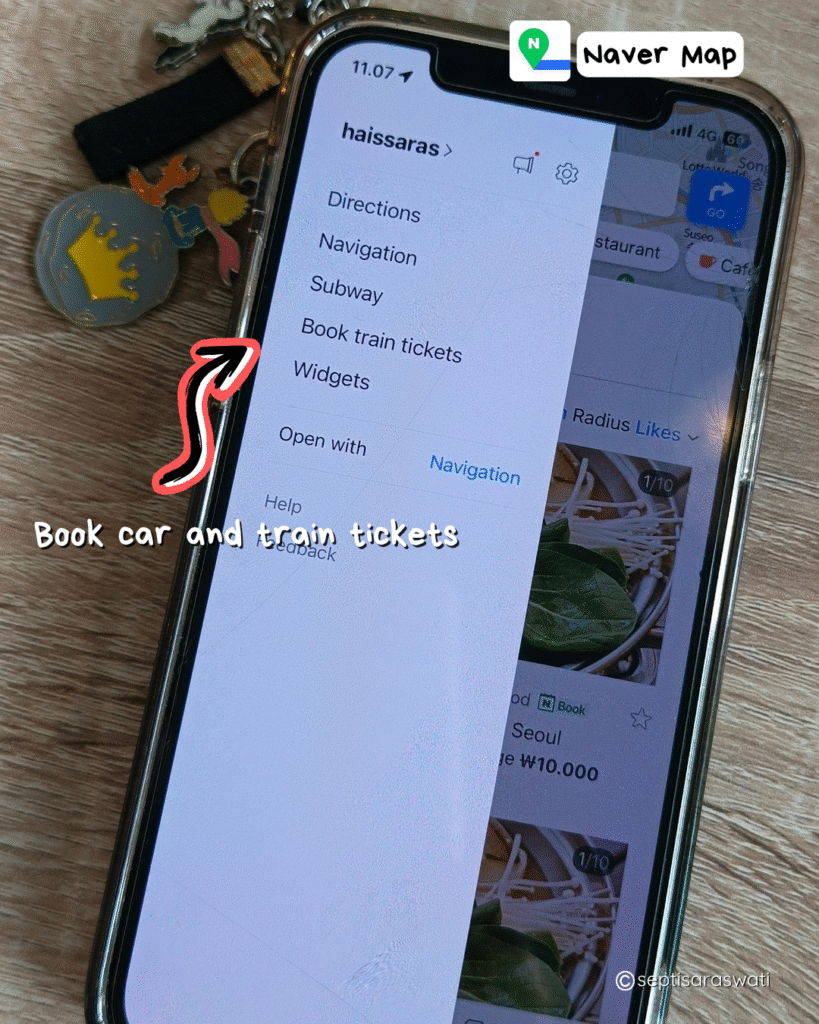
Note: I haven’t tried booking trains or cars through Naver Map myself, but you can give it a try!